Bakersfield
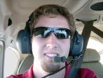
My first long distance flight would be to a city called Bakersfield in the central valley oven of California. But of course it isn't as hoping into an airplane and going there. A detailed plan of the flight was required before takeoff. With the operating manual, a sectional, and a flight log I charted a course like a lost soul over well charted territory, literally.
I'd make my first leg simple. We would go straight there. A straight line. Simple enough. Starting with a true course I found the wind direction. That gave me a heading. But the heading didn't correspond to a compass, so I needed the magnetic variation. But wait, the compass is off by a few degrees. Next, I went through speeds, times, fuel consumptions, checkpoint landmarks, airport and VOR frequencies, and performance calculations. All of this was on one sheet of paper. I am glad my road trips require quite a bit less attention.
Next came weather. I sorted though pages of weather briefings and NOTAMS. Nothing special here, other then the temperature at altitude was reported to be 85F.
But now with all that preplanned done, the flight went off without a hitch. My times were within a minute or two and the calculated course was off by no more than a few degrees. Shifting winds can't be predicted to well. We stayed long enough in Bakersfield to realize it was too damn hot, and headed for the cooler coastal breeze, but this time navigating by way of a nearby VOR.
Santa Ynez
My next flight was a bit spur of the moment. My instructor called me up at work to say he had time that night to make a flight, but with only a few hours of light, we could go far. The city of Santa Barbara would be preferable, but the Mode C transponder hasn't worked since I started flying despite numerous replacements. A smaller uncontrolled airstrip just outside the Class C airspace was another place I wanted to visit, but technically, Santa Ynez was to close to home and not a cross country. So my solution? Fly just a few mile north to Paso Robles, land, then start the cross country from there.
The flight planning came much easier now that I understood the flow. I would use simple visual checkpoints and dead reckoning to navigate my way to the small airstrip of Santa Ynez. There was only one small problem. The sun was setting fast as soon as we left Paso. The lakes and buildings I used as checkpoints faded quickly with the light. Ditching the original plan, we found the nearest highway and followed the ant like line of car lights travelling towards our destination. We landed just barely still in legal day VFR hours. Luckily, that was all the instructed day VFR x-country hours I needed, because the flight home would be my first time flying in complete night conditions. We followed the same line of lights right back to San Luis completing my second x-country trip.
Flight Hours Logged this week: 5.4
Total Flight Hours: 21.2
No comments:
Post a Comment